
Project partners at Shom have reached an important milestone for their task on assessing the burial probability of historic munitions in European seas: 3 TB of publicly available hydrosedimentary data have been analysed and condensed into a single data product. This data product will serve as input data for the munition burial model prototype to be developed next.
Within work package 4 (“subseafloor munition detection and classification”), project partners at Shom (France) are working on developing a probabilistic model prototype to predict burial of historic munitions in European seas. This knowledge would be beneficial when choosing methods for UXO detection and identification: appropriate survey methods and tools may vary depending on whether UXOs are expected to be lying on the seabed or buried in the sediment.
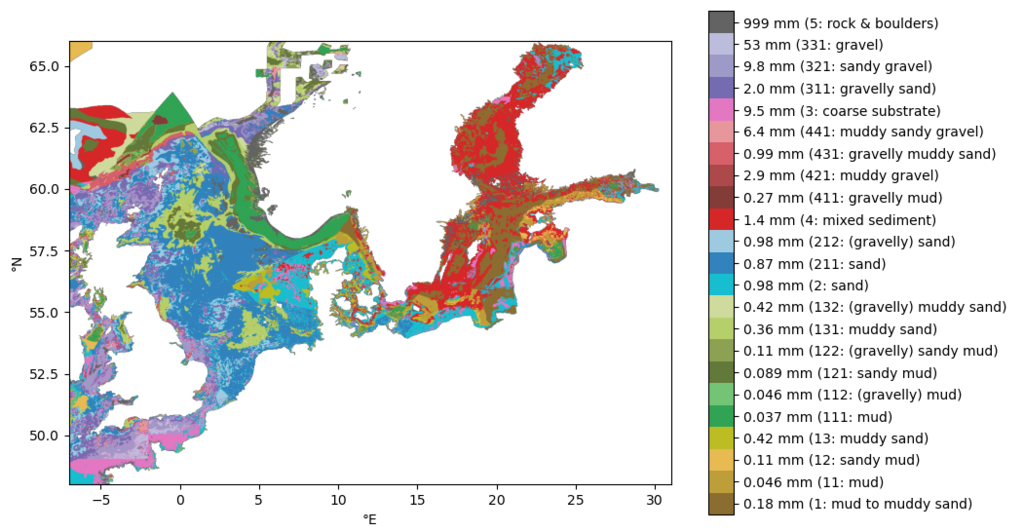
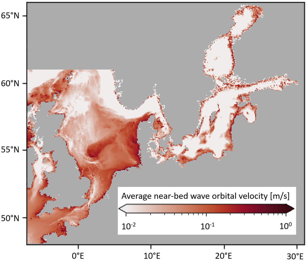
Munition burial depends largely on hydrosedimentary conditions at the bottom of the sea: local seabed sediment properties (e.g. grain size) and hydrodynamics (e.g. current speed) influence how deep historic munitions might be buried today. To assess this burial probability, data about past hydrosedimentary conditions are needed as input for the model. There are, however, two constraints: 1. No large-scale high-resolution hydrosedimentary time series are available for the whole period since the end of the two World Wars. 2. Due to process-related uncertainties, it is currently impossible to deterministically simulate UXO burial/unburial dynamics for such a long time period and a spatial extent covering multiple shelf seas. To overcome these constraints, we chose a probabilistic modelling approach that uses maps of statistical hydrosedimentary conditions as input. The input data are based on publicly available data products that cover the longest possible time period while still containing all necessary variables. EU Copernicus Marine Service and EMODnet Geology provide these data products. High-resolution current model data are available for a period of a few years, high-resolution wave model data are available for forty-five years, and seabed substrate type data do not contain any temporal variation. All data were assumed to be representative of the hydrosedimentary conditions for the whole studied time period. In total, the datasets amount to a size of 3 TB for the area of interest, which consists of the English Channel, North Sea and Baltic Sea.
In order to condense the data for the probabilistic modelling approach, a statistical analysis of the hydrodynamic data was performed. Among others, the discrete probability distributions of current speed and wave-induced speed values were computed. Additionally, a median grain size (d50) was estimated for each sediment class.
The final compiled and condensed data product is only 13 GB large and describes the statistical hydrosedimentary characteristics of the English Channel, North Sea and Baltic Sea. Now that the hydrosedimentary data has been compiled into a single data product, it will serve as input for the munition burial model prototype that will be developed during the next phase of the project.