
A Report about Good practices for historical data analyses and data compilation
Our new report, “Good practices for historical data analyses and data compilation” highlights approaches to working with historical data in UXO-related research. It reviews available historical data sources and their limitations, outlines methods for the manual compilation and analysis of historical information, and describes the use of GIS-based spatial techniques to identify areas of interest and potential UXO suspicion. The report also introduces automated document analysis using ErPaD as a complementary extension to traditional manual workflows.
The Report D11.1 "Good practices for historical data analyses and data compilation" presents a range of sources on the topic of munitions in the sea and outlines the processing steps involved, illustrated with practical examples from the North and Baltic Sea provided by the EOD Service Schleswig-Holstein, Germany (KRD-SH), and north.io. It also includes a section on the automated analysis of historical identification of dumped munition using AI tools. Overall, the report is intended to serve as a small guide to help compiling and analysing historical data.
The systematic analysis of historical data forms a central basis for identifying, assessing and prioritising munitions contamination on land and at sea. Until now, explosive ordnance disposal services in Germany – such as the Kampfmittelräumdienst Schleswig-Holstein (KRD-SH) – have traditionally focused on aerial image analysis and the clearance of munitions contamination and unexploded ordnance (UXO) or abandoned explosive ordnance (AXO) on land. For maritime areas, this methodological approach is increasingly being transferred to the marine environment (“mirroring the land side to the water side”).
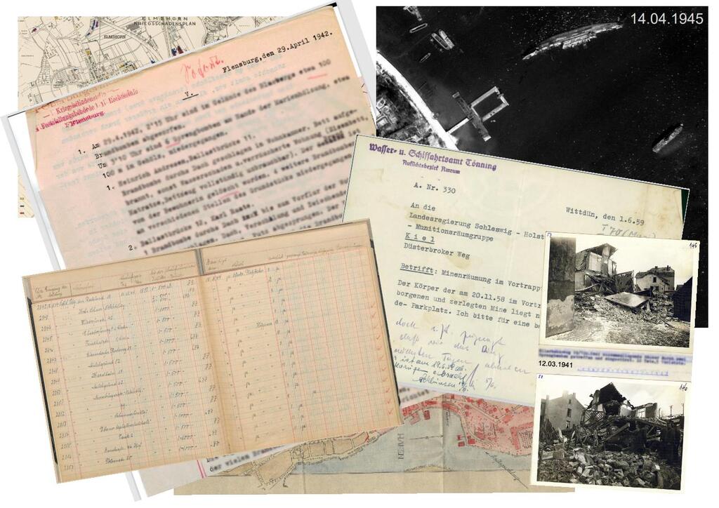
Significant quantities of dumped ammunition and UXO from the First and Second World War are particularly located in the Baltic and North Sea. The identification of dumping areas as well as the estimation of the type and quantity of dumped ammunition are mainly based on historical military documentation, among others. These archives contain essential information on ammunition stocks, transports, dumping activities, military (naval) operations and documented damage and losses. However, these available sources are often fragmented and in many cases only accessible in the form of handwritten notes, scanned or photographed documents and historical photographs. Their systematic indexing therefore requires a combination of traditional archive research and modern digital methods for data collection, structuring, and analysis. The objective of data analysis is to generate reliable situation reports, identify potential areas of risk and thereby contribute to the technically sound prioritisation of investigation and clearance measures.
Relevant document types include, among others:
- Military mission and situation reports
- War diaries and operational logs
- Administrative records at local and regional level
- Air protection police reports
- Cadastral and district records
- Damage surveys and historical photographs
- Strategic bombing surveys
- Reports of historical munitions finds and recoveries
- Lists of lost ships, logbooks and reports on wrecks
Photo credit of tile: KRD-SH